Index of photo albums
-- randallg's homepage
-- Kat Kam
If you got here from a search engine and you do not see the photo index frame on the left,
click here
.
Comments and questions to randallg@telemark.net
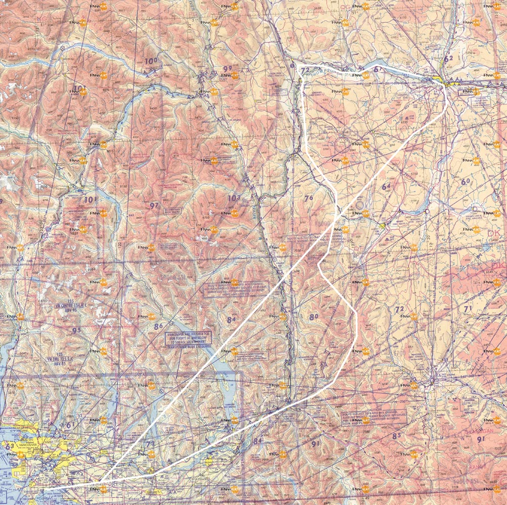
A beautiful fall day in Southwest British Columbia. Flight from Boundary Bay to Kamloops via Hope, Coquihalla River, Thynne Mt, Mount Stoyoma, Spences Bridge, Ashcroft, Cache Creek, and Kamloops Lake. Return via Lac Le Jeune, then GPS direct to Langley.
This page is best viewed at a resolution of at least 1600x1200 and with a fast Internet connection. The photos are at a native resolution of 1280x960, but they will resize to the size of your browser window. You may find it convenient to open the photos in a separate browser window - click your right mouse button and select "Open Link in New Window."
Piloting by Randall. Photography by Kat.
Here is a map of the route. Click here for a much larger detailed map.
Here is a map of the route. Click here for a much larger detailed map.