Index of photo albums
-- randallg's homepage
-- Kat Kam
If you got here from a search engine and you do not see the photo index frame on the left,
click here
.
Comments and questions to randallg@telemark.net
I wanted to see if south-west British Columbia has any fall colours. Having driven around the province a lot I knew that the Cariboo and Chilcotin regions can offer some good colours, but closer to Vancouver it's all pretty much evergreen. As you can see in these pictures, the deciduous trees are pretty sparsely scattered around. They are mostly along creeks and rivers, or in avalanche chutes. There are more of them the farther north and east from Vancouver you go.
Some of the pictures were taken at full digital zoom in a vibrating airplane, so they are a little blurry. I left them in anyway, sorry about that.
This page is best viewed at a resolution of at least 1600x1200 and with a fast Internet connection. The photos are at a native resolution of 1280x960, but they will resize to the size of your browser window. You may find it convenient to open the photos in a separate browser window - click your right mouse button and select "Open Link in New Window."
Piloting by Randall.
- 001 - 002 Hope - you can see the grass airfield parallel to the highway and railway
- 003 - Ridge just north-west of Hope
- 004 - Looking south up the Silver Creek
- 005 - 007 the ridge again
- 008 - 010 Hope Mt just north-east of Hope
- 011 - 012 Coquihalla Valley
- 013 - 014 Following Highway 3 towards Manning Park, looking south
- 015 - Passing the Hope Slide
- 016 - Looking south
- 017 - 019 The 8050' mountain just past the Hope Slide
I turned north of the highway to fly closer to the Three Brothers ridge and meadow area. The alpine meadows here are some of the most spectactular flowering meadows anywhere, in late July and early August, but sadly not now.
- 020 - Three Brothers Mt from the south-east
- 021 - Looking back a bit to the Fourth Brother
- 022 - Microwave tower at Blackwall peak - you can drive up to here and hike to the meadows
- 023 - Circling Blackwall Peak itself
- 024 - 025 Looking north-west from the microwave tower to Three Brothers
- 026 - Back over Highway 3 this is the Similkameen River
- 028 - Eastgate - there are some nice vacation properties here
- 032 - 033 The big copper mine south of Princeton
- 034 - Princeton from the south
- 036 - Highway 3 and Tulameen River near Princeton
- 037 - Looking south-east down the Similkameen Valley
- 038 - 040 The Tulameen River meets the Similkameen at Princeton
After flying over Princeton I follow the Tulameen River to the village of Tulameen, then turn north past Otter Lake and the Otter Valley towards Merritt.
- 041 - 050 - following the Tulameen River to Otter Lake
- 043 - The almost ghost town Coalmont
- 049 - Town of Tulameen and Otter Lake
- 051 - 056 - Otter Valley
- 057 - 060 Some little fishing lakes north east of the Otter Valley
- 061 - Looking south to Missezula Lake
- 063 - 066 I am fascinated by these cute little lakes, just south of the Okanagan Connector 97C near where it joins Highway 5A
- 067 - Passing north of Highway 97C, the landscape starts to get drier and sparser
- 071 - I am making a beeline for Quilchena, on the south shore of Nicola Lake. This is Quilchena Creek
- 073 - 075 Circling over Quilchena. There is an old historic hotel, and it has a gravel airstrip
- 076 - Heading west to Merritt airstrip for landing and fuel
Taking off from Merritt, I just followed the Coquihalla Highway to Hope. By the time I got to the higher mountains I was heading right into the hazy late afternoon sun, so my visibility decreased dramatically. It was almost difficult to follow the valleys!
- 081 - 098 Heading south along the Coldwater Valley
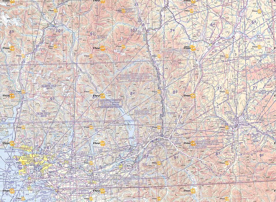
Here is a map of the route. Click here for a much larger detailed map.